Coney Island
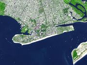
Coney Island is a peninsula, formerly an island, in southernmost Brooklyn, New York City, USA, with a beach on the Atlantic Ocean. The neighborhood of the same name is a community of 60,000 people in the western part of the peninsula, with Seagate to its west; Brighton Beach and Manhattan Beach to its east; and Gravesend to the north.
The area was a major resort and site of amusement parks that reached its peak in the early 20th century. It declined in popularity after World War II and endured years of neglect. In recent years, the area has seen the opening of MCU Park, home to the Brooklyn Cyclones minor league baseball team.
Contents |
Geography
Coney Island is the westernmost of the barrier islands of Long Island, about four miles (6 km) long and one-half mile wide. It used to be an island, separated from the main part of Brooklyn by Coney Island Creek, part of which was little more than tidal flats. There were plans into the 20th century to dredge and straighten the creek as a ship canal, but they were abandoned and the center of the creek was filled in for construction of the Belt Parkway before World War II. The western and eastern ends are now peninsulas.
History
The name
Native American inhabitants, the Lenape, called the island Narrioch (land without shadows), because, as is true of other south shore Long Island beaches, its compass orientation keeps the beach area in sunlight all day. The Dutch name for the island was Conyne Eylandt (Konijnen Eiland in modern Dutch spelling),[2] meaning Rabbit Island. This name is found on the New Netherland map of 1639 by Johannes Vingboon. (New York State and New York City were originally a Dutch colony and settlement, named Nieuw Nederlandt and Nieuw Amsterdam.) As on other Long Island barrier islands, Coney Island had many and diverse rabbits and rabbit hunting prospered until resort development eliminated their habitat.
It is generally accepted by scholars[3][4] that Coney Island is an English adaptation of the Dutch name, Konijnen Eiland. Coney is also an archaic and dialectal English word for rabbit. Coney came into the English language through Old French (Conil), which derives from the Latin word for rabbit, cuniculus. The English name "Conney Isle" was used on maps as early as 1690,[5] and by 1733 the modern spelling "Coney Island" was used.[6] J.F.W. des Barre's chart of New York harbor in the Atlantic Neptune, 1779,[7] and John Eddy map of 1811 both use the modern "Coney Island" spelling.[8]
Even though the history of Coney Island's name and its Anglicization can be traced through historical maps spanning the 17th century to the present,[9] and all the names translate to "Rabbit Island" in modern English, there are still those who contend that the name derives from other sources. Some say that early English settlers named it Coney Island after its cone-like hills. Others claim that an Irish captain named Peter O'Connor had, in the 1700s, named Coney Island after an island (Inishmulclohy) in County Sligo, Ireland. Yet another purported origin is from the name of the Indian tribe (the Konoh tribe) who supposedly once inhabited it. A further claim is that the island is named after Henry Hudson's "right-hand-man" John Coleman, supposed to have been slain by Indians.[10]
The resort
Coney Island became a resort after the Civil War as excursion railroads and the Coney Island & Brooklyn Railroad streetcar line reached the area in the 1860s, and the Iron steamboat company in 1881. With the rail lines, steamboat lines and access to the beach came major hotels and public and private beaches, followed by horse racing, amusement parks, and less reputable entertainments such as Three-card Monte, other gambling entrepreneurs, and prostitution.
When the Brooklyn Rapid Transit Company electrified the steam railroads and connected Brooklyn to Manhattan via the Brooklyn Bridge at the beginning of the 20th century, Coney Island turned rapidly from a resort to an accessible location for day-trippers seeking to escape the summer heat in New York City's tenements.
Charles I. D. Looff, a Danish woodcarver, built the first carousel at Coney Island in 1876. It was installed at Vandeveer's bath-house complex at West 6th Street and Surf Avenue. The complex was later called Balmer's Pavilion. The carousel consisted of hand-carved horses and animals standing two abreast. Two musicians, a drummer and a flute player, provided the music. A metal ring-arm hung on a pole outside the ride, feeding small, iron rings for eager riders to grab. A tent-top protected the riders from the weather. The fare was five cents.
From 1885 to 1896, the Coney Island Elephant was the first sight to greet immigrants arriving in New York, who would see it before they saw the Statue of Liberty.
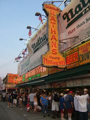
Nathan's Famous original hot dog stand opened on Coney Island in 1916 and quickly became a landmark. An annual hot dog eating contest has been held there on July 4 since its opening, but has only attracted broad attention and international television coverage during the last decade.
In 1915 the Sea Beach Line was upgraded to a subway line, followed by the other former excursion roads, and the opening of the New West End Terminal in 1919 ushered in Coney Island's busiest era.[11]
After World War II, contraction began seriously from a series of pressures. Air conditioning in movie theaters and then in homes, along with the advent of automobiles, which provided access to the less crowded and more appealing Long Island state parks, especially Jones Beach, lessened the attractions of Coney's beaches. Luna Park closed in 1946 after a series of fires and the street gang problems of the 1950s spilled into Coney Island.
The presence of threatening youths did not impact the beachgoing but discouraged visitors to the rides and concessions, staples of the Coney Island economy. The local economy was particularly impacted by the 1964 closing of Steeplechase Park, the last of the major amusement parks.
Development

Development on Coney Island has always been controversial. When the first structures were built around the 1840s, there was an outcry to prevent any development on the island and preserve it as a natural park. Starting in the early 1900s, the City of New York made efforts to condemn all buildings and piers built south of Surf Avenue. The local amusement community opposed the city. Eventually a settlement was reached where the beach did not begin until 1,000 feet (300 m) south of Surf Avenue, the territory marked by a city-owned boardwalk, while the city would demolish any structures that had been built over public streets, to reclaim beach access.
In 1944, Robert Moses actively opposed the "tawdry" entertainment at Coney and discouraged the building of new amusements. By 1949, Moses moved the boardwalk back from the beach several yards, demolishing many structures, including the city's municipal bath house. He would later demolish several blocks of amusements to clear land for both the New York Aquarium, where Dreamland once stood, and the Abe Stark ice skating rink. In 1953, Moses had the entire island rezoned for residential use only and announced plans to demolish the amusements to make room for low income housing. After public complaints, the Estimate Board reinstated some areas as protected for amusement use only, leading to many public land battles.
In 1964, Coney Island's last remaining large theme park, Steeplechase Park, closed and the property was sold to developer Fred Trump. Trump wanted to build luxury apartments on the old Steeplechase property and spent ten years battling in court to get the property rezoned. After a decade of court battles, Trump exhausted his legal options and the property remained zoned for amusements. He eventually leased the property to Norman Kaufman, who ran a small collection of fairground amusements on a corner of the site calling his amusement park Steeplechase Park.
But between the loss of both Luna Park and the original Steeplechase Park, as well as an urban-renewal plan that took place in the surrounding neighborhood where middle class houses were replaced with low income housing projects, fewer people visited Coney Island. In the late 1970s, the city came up with a plan to revitalize Coney Island by bringing in gambling casinos, as had been done in Atlantic City. But gambling was never legalized for Coney, and the area ended up with vacant lots.
In 1994, Rudy Giuliani took office as mayor of New York supported a plan to build Sportsplex, provided it include a stadium for a minor-league team owned by the Mets. As soon as the stadium was completed, Giuliani killed the Sportsplex deal. The Mets decided the minor league team would be called The Brooklyn Cyclones and sold the naming rights to the stadium to Keyspan Energy. Executives from Keyspan complained that the stadium's line of view from the rest of Coney Island amusement area was blocked by the derelict Thunderbolt coaster. The following month, Giuliani ordered an early-morning raid on the Thunderbolt and had it bulldozed.
In 2003, Mayor Michael Bloomberg took an interest in revitalizing Coney Island as a possible site for the 2012 Olympics. When the city lost the bid for the Olympics, revitalization plans were rolled over to The Coney Island Development Corporation (CIDC), which came up with a plan to restore the resort. Shortly before the CIDC's plans were released, a development company, Thor Equities, purchased all of Bullard's western property, sold it to Taconic, and used much of the proceeds to purchase property or offer to purchase every piece of property inside the traditional amusement area. The in September 2005, Thor went public with a plans to build a large Bellagio-style hotel resort surrounded by rides and amusements. The renderings of the hotel took up the entire amusement area from the Aquarium to beyond MCU Park and required the demolition of The Wonder Wheel, Cyclone, and Nathan's original hot dog stand, as well as the new MCU Park.
Late in 2006 Thor purchased Coney Island's last remaining amusement park, Astroland, and announed plans to close it after the 2007 season and build a Nickelodeon-themed hotel on the site. In January 2007 Thor released renderings for a new amusement park to be built on the Astroland site called Coney Island Park.[12] In the winter of 2007 Thor began to evict businesses from the buildings it owned along the boardwalk. But when one of the business owners complained Thor reinstated their leases.
The Municipal Art Society launched the initiative ImagineConey[13] in early 2007, as discussion of a rezoning plan that highly favored housing and hotels began circulating from the Department of City Planning.[14] City Planning certified the rezoning plan in January 2009 to negative responses from all amusement advocates and Coney Island enthusiasts. The plan is currently working through the ULURP process.[15] Thor Equities has said it hopes to complete the project by 2011.[16] The Aquarium is also planning a renovation.[17] In June 2009, the city's planning commission unanimously approved the construction of 4,500 units of housing and 900 affordable units and vowed to "preserve, in perpetuity, the open amusement area rides that everyone knows and loves," while protesters argued that "20 percent affordable-housing component is unreasonably low." [18]
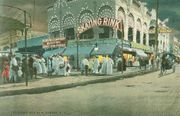
The Coney Island amusements
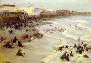
Between about 1880 and World War II, Coney Island was the largest amusement area in the United States, attracting several million visitors per year. At its height it contained three competing major amusement parks, Luna Park, Dreamland, and Steeplechase Park, as well as many independent amusements.
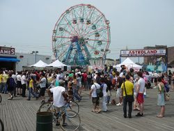
Astroland served as a major amusement park from 1962 to 2008.[19] It was replaced by a new incarnation of Dreamland in 2009 and of Luna Park in 2010. The other parks and attractions are: Deno's Wonder Wheel Amusement Park (a successful family owned park with over 20 rides located directly on the Boardwalk), 12th Street Amusements, and Kiddie Park. Also, the Eldorado arcade has its own indoor bumper car ride. The Zipper and Spider on 12th Street were closed permanently on September 4, 2007 and dismantling begun, after its owner lost his lease. They are to be reassembled at an amusement park in Honduras.[20]
Rides

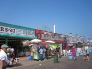
Today, the amusement area contains various rides, games such as skeeball, ball tossing, and a sideshow; games of shooting and throwing and tossing skills.
The rides and other amusements at Coney Island are owned and managed by several different companies, and operate independently of each other. It is not possible to purchase season tickets to the attractions in the area.
Three rides at Coney Island are protected as designated NYC landmarks and listed in the National Register of Historic Places.
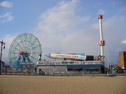
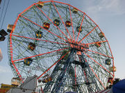
- Wonder Wheel. Built in 1918 and opened in 1920, this steel Ferris wheel has both stationary cars and rocking cars that slide along a track. It holds 144 riders, stands 150 feet (46 m) tall, and weighs over 2,000 tons. At night the Wonder Wheel's steel frame is outlined and illuminated by neon tubes. It is part of Deno's Wonder Wheel Amusement Park.[21]
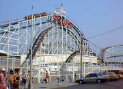
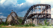
- The Cyclone roller coaster, built in 1927, is one of the nation's oldest wooden coasters still in operation. A favorite of some coaster aficionados, the Cyclone includes an 85-foot (26 m), 60 degree drop. It is owned by the City, and was operated by Astroland, under a franchise agreement. It is located across the street from Astroland.
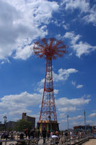
- The Parachute Jump, originally the Life Savers Parachute Jump at the 1939 New York World's Fair, was the first ride of its kind. Patrons were hoisted 190 feet (58 m) in the air before being allowed to drop using guy-wired parachutes. Although the ride has been closed since 1968, it remains a Coney Island landmark and is sometimes referred to as Brooklyn's Eiffel Tower. Between 2002 and 2004, the Jump was completely dismantled, cleaned, painted and restored, but remains inactive. After an official lighting ceremony in July 2006, the Parachute Jump was slated to be lit year round using different color motifs to represent the seasons. However, this idea was scrapped when New York City started conserving electricity in the summer months. It has not been lit regularly since.
Other notable attractions include the following:
- The B&B Carousell [sic] (that was how the frame's builder, William F. Mangels, spelled it). In addition to its unusual spelling, it is Coney Island's last traditional carousel, now surrounded by furniture stores, near the old entrance to Luna Park. The carousel is an especially fast one, with a traditional roll-operated band organ. When the long-term operator died unexpectedly, the carousel was put up for auction, and it was feared the ride would leave Coney Island or, worse, that it would be broken up for sale to collectors, being one of the last intact traditional carousels in the U.S. still in private hands. In an act of brinksmanship with the owners, the City of New York bought the B&B Carousell a few days before the auction. It has been dismantled and will operate in Coney Island; the specific location is still to be determined. All the other carousels on Coney Island are kiddie park-style.
- Bumper cars. There are three separate bumper car rides in Coney Island, located in Astroland, Deno's Wonder Wheel Park, and Eldorado's Arcade on Surf Avenue.
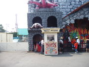
- Haunted houses. Three traditional dark ride haunted houses operate at Coney Island: Dante's Inferno (Astroland), Spook-a-Rama (Deno's) and the Ghost Hole (independent).
Rides of the past
- Thunderbolt, a roller coaster across the street from Steeplechase Park that was constructed in 1925. The ride closed in 1983. It was torn down by the city "to protect public safety" in 2000 during the construction of nearby Keyspan Park. In the Woody Allen movie "Annie Hall", Allen's character's family lives in the small house like structure under the rear of the roller coaster track.
- Tornado, a roller coaster constructed in 1926. It suffered a series of small fires which made the structure unstable and was torn down in 1977.
Other parks and venues
Coney Island is also the location of the New York Aquarium, which opened in 1957 on the former site of the Dreamland amusement park. In 2001, KeySpan Park opened on the former site of Steeplechase Park to host the Brooklyn Cyclones minor-league baseball team.
In August 2006 Coney Island hosted a major national volleyball tournament sponsored by the Association of Volleyball Professionals. The tournament, usually held on the West Coast, was televised live on NBC. The league built a 4,000-seat stadium and 12 outer courts next to the Boardwalk for the event. Its promotional partner is Brooklyn Sports and Entertainment. The tournament would return to Coney Island in 2007 and 2008.
In April 2009, Feld Entertainment, parent company to Ringling Bros. and Barnum & Bailey Circus, announced that The Greatest Show On Earth would perform in Coney Island for the entire summer of 2009—the first time since July 16, 1956 that Ringling Bros. would perform under the Big Top. The tent complex is located on 21st Street on the lot between the boardwalk and Surf Avenue. The show is called The Coney Island BOOM A RING. In 2010, Feld returned with The Coney Island Illuscination at the same location.
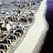
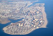
The beach

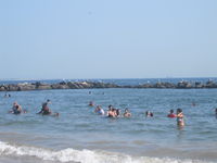
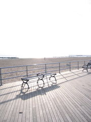
Coney Island still maintains a broad sandy beach from West 37th Street at Seagate through the Coney Island and Brighton Beach to the beginning of the community of Manhattan Beach, a distance of approximately 2½ miles (~4.0 km). The beach is continuous and is served for its entire length by the broad Riegelmann boardwalk. A number of amusements are directly accessible from the land side of the boardwalk, as is the New York Aquarium and a variety of food shops and arcades.
The beach is groomed and replenished on a regular basis by the city. The position of the beach and lack of significant obstructions means virtually the entire beach is in sunlight all day. The beach is open to all without restriction and there is no charge for use. The beach area is divided into "bays", areas of beach delineated by rock jetties, which moderate erosion and the force of ocean waves.
The Coney Island Polar Bear Club is a group of people who swim at Coney Island throughout the winter months, most notably on New Year's Day when additional participants join them to swim in the frigid waters.[22] The rest of the year, Coney Island beach serves as a training area for the Coney Island Brighton Beach Open Water Swimmers, a group dedicated to promoting open water swimming for individuals at all levels, and to improvement of water quality of New York City's beaches and rivers.
Mermaid Parade
The Coney Island Mermaid Parade, which takes place on Surf Avenue and the boardwalk, featuring floats and various acts, has been produced annually by Coney Island U.S.A. — a non-profit arts organization which is dedicated to preserving the dignity of American popular culture. The group, which was established in 1979, also produces the Coney Island Film Festival, Burlesque At The Beach, and Creepshow at the Freakshow (an interactive Halloween-themed event), and houses the Coney Island Museum.
Film Festival
Every October since 2000, Coney Island USA sponsors the Coney Island Film Festival.[23]
Demographics
As of 2000 census, there were 51,205 people living in Coney Island. Of those people, 29.3% were Black or African American, 51.2% were White, 18% were Hispanic or Latino, 3.8% were Asian, 0.5% were Native American, 0.1% were Pacific Islander, 7.6% were some other race and 3.7% were two or more races. 70.5% had a high school degree or higher, 20.7% had a bachelor's degree or higher. The median household income as of 1999 was $21,281.
The communities
The neighborhoods on Coney Island, running eastward are Sea Gate (a private community), Coney Island proper, Brighton Beach, and Manhattan Beach.
Sea Gate is one of a handful of neighborhoods in New York City where the streets are owned by the residents and not the city; it and the Breezy Point Cooperative are the only city neighborhoods cordoned off by a fence and gate houses.
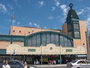
Its main subway station is called Coney Island – Stillwell Avenue and is served by the D F N Q trains of the New York City Subway. The terminal is the largest elevated metro station in North America with 8 tracks serving the 4 services that use the station. The entire station was rebuilt in 2002-2004 into a modern station with a large solar-panel canopy covering all 8 tracks. The three main avenues in the Coney Island community, are (north to south) Neptune Avenue (which crosses to the mainland to become Emmons Avenue), Mermaid Avenue, and Surf Avenue (which becomes Ocean Parkway and then runs north towards Brooklyn's Prospect Park).
The cross streets in the Coney Island neighborhood proper are numbered with "West" prepended to their numbers, running from West 1st Street to West 37th Street at the border of Sea Gate.
The majority of Coney Island's population resides in approximately thirty 18- to 24-story towers, mostly various forms of public housing. In between the towers are many blocks that were filled with burned out and vacant buildings. Since the 1990s there has been steady revitalization of the area. Many townhouses were built on empty lots, popular franchises have set up shop, and Keyspan Park was built to serve as the home for the Cyclones, a minor league baseball team in the New York Mets' farm system. Once home to many Jewish residents, most of those living on Coney Island today are African American, Italian American, Hispanic and recent Russian and Ukrainian immigrants.
Education
Coney Island is served by the New York City Department of Education.
The Coney Island neighborhood is zoned to PS 90 (K-5) and IS 303 Herbert S. Eisenberg (6-8). PS/IS 288 The Shirley Tanyhill School (Pre-K-8), PS 329 (K-5), PS 188 The Michael E. Berdy School (K-5), PS 100 (K-5), and Mark Twain (6-8) are all schools located in the heart of Coney Island. There are no zoned high schools.
Nearby high schools include:
- Abraham Lincoln High School
- John Dewey High School
- Leon Goldstein High School for Sciences at Kingsborough
- Rachel Carson's School of Coastal Studies
- William E. Grady Vocational High School
- The High School Of Sports Management
Transportation
The neighborhood is served by the Coney Island – Stillwell Avenue station (D F N Q trains) of the New York City Subway. There is also a bus terminal beneath the station. The buses that terminate there are the B68 to Prospect Park, the B74 to the Coney Island-Seagate border at West 37th Street via Mermaid Avenue, and the B82 to Starett City. The B36 runs from the Coney Island-Seagate border at West 37th Street to Nostrand Avenue at Avenue U in Sheepshead Bay, Brooklyn. The X28 provides express service to Manhattan.
Coney Island in popular culture
In literature
- Hubert Selby Jr.'s "Requiem for a Dream" is set in Coney Island.
- "A Coney Island of the Mind" by Lawrence Ferlinghetti is a classic collection of poems from the Beat era. The title was inspired by Henry Miller's work.
- The Warriors by Sol Yurick is the 1965 novel that the 1979 movie with the same name (see above) was based upon. The novel itself is loosely based upon Anabasis by Xenophon. Today, some Coney Island gift shops sell t-shirts and other merchandise based on the film.
- Samantha at Coney Island by "Josiah Allen's Wife" (Marietta Holley), 1911, was a popular young-adult novel in the early 20th century.
- Coney Island features prominently in Joseph Heller's novel, Closing Time.
- Coney Island Wonder Stories, edited by Robert J. Howe and John Ordover, 2005, contains science fiction and fantasy stories set in Coney Island throughout its history, by Kristine Kathryn Rusch, Steven Popkes, Maureen McHugh, Mike Resnick, J. R. Dunn, Kij Johnson, Paul Levinson, and other writers.
- In It's Like This, Cat, Dave and Cat go to Coney Island in a chapter.
- In The Great Gatsby, Gatsby invites Nick to go to Coney Island after his meeting with Jordan Baker.
- In "Coney" by Amram Duchovny, a tale about 1930s Coney Island as told from the perspective of a 15-year-old Jewish boy as he relates his interactions with his family, the group of freaks from Coney's sideshow, the midget who owns the bike shop on the boardwalk, the wheelchair crime boss with arson on his mind, and many other colorful characters from this historic Brooklyn landmark.
- Poem "Coney Island" by Jose Martí in 1881
- Coney Island is often mentioned in O.Henry's stories.
- In Twelve by Nick McDonell, a novel about a group of rich kids in Manhattan who pass their time taking drugs and partying, the protagonist, White Mike, visits Coney Island. The amusement area is described very negatively (shabby, run-down, deserted, no kids, but hookers and drug dealers).
- In "Amusing the Million: Coney Island at the Turn of the Century" by John F. Kasson, the author "examines the historical context in which Coney Island made its reputation as an amusement park and shows how America's changing social and economic conditions formed the basis of a new mass culture."
- In Kevin Baker's book Dreamland, much of the drama and pivotal moments take place in the vicinity of Coney Island and its amusement parks.
- "The Last Shot" by Darcy Frey follows a group of high school basketball players from Coney Island.
- "Wonderland" a poem by Trash about the Junkyard Baseball Venue. The poem, set in Coney Island, follows a young man's journey from a local park (the mythical Junkyard) to the major leagues.
- In Rachel Trezise's short story collection "Fresh Apples", there is a story called "Coney Island" set partly in Coney Island in Brooklyn, and partly in Coney Beach, Porthcawl, South Wales, a beach and funfair named after New York's Coney Island.
- "The Electric Michelangelo", a novel by British novelist Sarah Hall, is set partly in Coney Island and describes much of the amusement area as it was at its peak prior to World War 2 and describes some of its post-war decline.
- In the comic book "GI Joe", the character Scarface lived under an abandoned roller coaster on Coney Island.
In film and on stage
Listed chronologically
- The 1917 film Coney Island, starring Buster Keaton, was set in Coney Island.
- The 1927 silent film It, starring Clara Bow, features a trip to the park and a tour of the historic rides.
- In the 1928 silent film Speedy, Harold Lloyd spends a day at Coney Island with his girlfriend.
- It was the title and the setting for the 1943 Betty Grable musical, Coney Island.
- Brothers Moe, Shemp and Curly Howard, members of the slapstick comedy team the Three Stooges, all hailed from Brooklyn and made several references to Coney Island. In the 1946 Western-themed The Three Troubledoers, Curly quips "Badlands Blackie is no match for ol' Coney Island Curly, n'yuk, n'yuk, n'yuk." In the 1946 pirate-themed Three Little Pirates, Moe advises that the great "Maharaja" (Curly) has fair maidens on his islands of "Coney" and "Long".
- In the 1948 film Texas, Brooklyn and Heaven, Mandy (Florence Bates) takes Eddie (Guy Madison) to Coney Island where Perry (Diana Lynn) works in swimsuit in an amusement booth.
- In the critically acclaimed 1953 independent film Little Fugitive, a small boy runs away to Coney Island after thinking he has killed his brother.
- In the movie Angel Heart, Mickey Rourke goes to Coney Island, to gather information on his case. The Wonder Wheel is seen in the background.
- A Coney Island amusement park is the setting of the Rhedosaurus' last stand in the 1953 sci-fi film The Beast from 20,000 Fathoms.
- In Remo Williams: The Adventure Begins, Remo Williams played by Fred Ward is seen doing workout exercises on the Wonder Wheel, as well as playing boardway games on Coney Island.
- In the 1968 Disney comedy The Love Bug, David Tomlinson and Buddy Hackett spend an evening consuming a barrelful of Irish coffee. In a drunken exchange, Tomlinson asks Hackett "What part of Ireland did you say your mother was from?" Hackett cackles back "Coney Ireland!"
- In the 1973 Peter Bogdanovich film Paper Moon, Moses Prey (played by Ryan O'Neal) tells Addie (played by Tatum O'Neal) to "Eat your Coney Island and drink your Nehi".
- Perhaps the most famous fictional residents of Coney Island come from Walter Hill's 1979 cult film The Warriors. Based on Sol Yurick's novel, the film charts the progress of a street gang called "The Warriors" as they travel from their Coney Island turf up to a meeting in the Bronx, get framed for killing a powerful gang leader, and then have to fight their way back to Coney Island with gang members and police chasing them.
- Alvy Singer, the lead character in Woody Allen's 1977 semi-autobiographical film classic Annie Hall lived in Coney Island as a child in a house that was under the Thunderbolt rollercoaster that shook wildly every time the coaster made its rounds. Alvy's father ran the bumper cars' concession.
- In the 1982 film Sophie's Choice, the characters played by Meryl Streep, Kevin Kline and Peter MacNicol spend 'Dress-Up Sunday' at Coney Island. Prior to this, Sophie exclaims "Coney Island - Oh boy!" with unparalleled enthusiasm.
- Neil Simon's 1983 play Brighton Beach Memoirs (also a 1986 movie) depicts growing up in the Coney Island area, and features scenes with the Coney Island rollercoaster in the background.
- In the 1984 crime epic Once Upon a Time in America, the character played by Robert De Niro is seen standing beside an advertisement of Coney Island.
- In the film The Pick-Up Artist, Molly Ringwald's Character lives in Coney Island, Right across from Nathan's Famous Hot Dogs
- Director Paul Mazursky shot two movies with Coney Island segments, Enemies: A Love Story and Winchell.
- Coney Island is a location in Darren Aronofsky's first two films, Pi and Requiem for a Dream, specifically Brighton Beach for the latter. Darren Aronofsky grew up in Brighton Beach.
- In the film Alien Nation (film), James Caan's character makes a reference to a Coney Island Whitefish.
- The movie Two Lovers is set in Brighton Beach. Starring in the movie is Gwyneth Paltrow whose mother Blythe Danner played in the movie Brighton Beach Memoirs.
- The 1998 drama He Got Game takes place in Coney Island
- The 1999 Bollywood movie Aa Ab Laut Chale has few scenes and a song "Janeman Janeman" that were shot on the boardwalk of Coney Island. Aishwarya Rai wore a swimsuit in this song which made it a bit controversial in India.
- In the episode "The Subway" (1991) of the TV series Seinfeld, Jerry Seinfeld visits Coney Island to go on the rides.
- The episode "Where's Johnny?" of "The Sopranos" has a scene at Coney Island.
- In a Dora the Explorer episode, Dora and Boots go to "Coney Island"
- In 2003 in the movie "Uptown Girls" with the late Brittany Murphy, Dakota Fanning's character runs off to Coney Island.
- The 2005 film Unknown White Male begins with the lead character waking-up on Coney Island with a sudden case of retrograde amnesia.
- A.I. A.I. 2001 film, directed by Steven Spielberg featuring Haley Joel Osment - David and Teddy take a submersible to the Blue Fairy, which turns out to be a statue from a submerged attraction at Coney Island. Teddy and David become trapped when the park's ferris wheel falls on their vehicle.
- The final scene of the 2008 movie Cloverfield shows the main characters on the ferris wheel at Coney Island
- In the 2009 movie The Taking of Pelham 123, the scene with the run away 6 train into Coney Island.
- In an episode of Ugly Betty, Gio takes Betty and DJ (Daniel Junior) to Coney Island to hide from his grandparents who are going to take him back to France.
- Love Never Dies, the sequel to The Phantom of the Opera takes place on Coney Island and opens in London March 9, 2010 (and will on Broadway spring, 2011).
- Coney Island will be portrayed in the film Last Days of Coney Island, written and directed by Ralph Bakshi.
In music


- An early musical reference came in 1926 with "Coney Island Washboard Roundelay", music by Hampton Durand and Jerry Adams, words by Ned Nestor and Aude Shugart. The song is commonly accompanied by a percussionist playing a washboard.
- "Goodbye, My Coney Island Baby" was written in 1948 by Les Applegate and is often included in the repertoire of a barbershop quartets.
- American country singer Jimmy Davis references Coney Island in his song "Where The Old Red River Flows".
- Australian modern classical composer Don Banks (1923–1980) composed a short orchestral work called "Coney Island" around 1960 to 1961, which gives a vivid musical picture of the amusement park. It was included on an L.P. record, "Musical Merry-go-round", released in 1961, with music by various composers inspired by the circus and fairground world, played by the Sinfonia of London, conducted by Douglas Gamley and Robert Irving.
- American singer-songwriter Lou Reed's 1976 album is entitled Coney Island Baby and features the track "Coney Island Baby".
- American Instrumental Band Herb Alpert & The Tijuana Brass has a song called "Coney Island" composed by Julius Wechter from their 1975 album Coney Island.
- American rock band Aerosmith has a song called "Bone to Bone (Coney Island Whitefish Boy)" from their 1979 album Night in the Ruts.
- The debut album of the American jazz band The Lounge Lizards contains a song called "I Remember Coney Island".
- American rock band Joan Jett & the Blackhearts has a song called "Coney Island Whitefish" from their 1982 album Album.
- American rock band Velvet Underground have a song called "Coney Island Steeplechase" on their 1986 album Another View.
- British Group Swing Out Sister recorded a track called "Coney Island Man" during their "Kaleidoscope World" sessions and featured on their single "You On My Mind" in 1989.
- Pop group New Kids on the Block filmed parts of the video for "Please Don't Go Girl" at Coney Island. Several rides including the Wonder Wheel and the Hell Hole are shown.
- American rock band Mercury Rev references Coney Island in the song "Coney Island Cyclone", from their 1991 album Yerself Is Steam.
- American synth-pop band The Magnetic Fields references Coney Island in "Strange Powers" from 1994's Holiday''.
- American alternative rap / alternative rock group Fun Lovin' Criminals has a song called "Coney Island Girl" on their 1996 album Come Find Yourself.
- American rock band Death Cab for Cutie have a song called "Coney Island" from their 2001 album, The Photo Album.
- American singer-songwriter Tom Waits has a song called "Coney Island Baby," on his 2002 album Blood Money. He also references Coney Island in his songs "Table Top Joe" from the 2002 album Alice and "Take It With Me" from the 1999 album Mule Variations.
- New York singer/songwriter and banjo contortionist, Curtis Eller has a song "Coney Island Blue" on his 2004 album "Taking Up Serpents Again"
- Brooklyn, New York indie rock band, The Honey Brothers (which features Adrian Grenier on percussion) have a track titled "Coney Island Baby (I Am Yours)" which is available for download at their MySpace URL.
- German punk band The Flunkeys released a single from their 2007 album, No Riot, called "Coney Island".
- American Detroit, Michigan native rapper Bizarre's 2007 album release is titled "Blue Cheese 'n' Coney Island" referring to the style of chili dog.
- American band Beat Circus' 2008 album entitled Dreamland, references the turn-of-the-century Coney Island theme park Dreamland in several of its songs including Coney Island Creepshow and Hell Gate, and includes historical images and postcards of early Coney Island donated by the Coney Island Museum.
- The Franz Ferdinand song Eleanor Put Your Boots Back On features lyrics about a girl in New York, and includes the lines '"But if you run you can run to the Coney Island roller coaster / Ride to the highest points / And leap across the filthy water'".
- The Godspeed You! Black Emperor song "Sleep" features Murray Ostril reminiscing over the glory days of Coney Island, supposedly in a post-apocalyptic existence.
- Cyndi Lauper's 1994 DVD entitled "Twelve Deadly Cyns And Then Some" contains footage of the singer spending an afternoon at Coney Island. Refer to IMDB for verification.
- In 2008, reggaeton singer De La Ghetto filmed some parts of his video Es Dificil in Coney Island. The Wonder Wheel is visible in some parts of the video.
- The 311 Song "Welcome" from their album Music makes reference in the lyric "A Coney Island of the mind it's mine // I swipe the sweets strip the beats in the sunshine"
- In the episode of The Golden Girls entitled "Sophia's Wedding" Sophia mentions how her late husband Sal and his business partner used to run a pizza & knish stand at Coney Island.
- British band Tears for Fears' song Call Me Mellow on their album Everybody Loves a Happy Ending includes the lyric '"We'd live on ice-cream on Coney Island '".
- The indie/folk-rock band Good Old War have a song called "Coney Island" on their debut album, Only Way To Be Alone.
- Coney Island is mentioned in David Bowie's song "Slip Away" from his album Heathen.
- American Hip Hop artist Bobby Bloodbath of Coney Island, NY references his hometown in a guest appearance on "Concerto del Muerto" a track off of the Wax and EOM album entitled Liquid Courage, released independently by AGP in December 2008.
- American rap group Onyx mentioned the place in the start of their song "Shut 'Em Down".
- In 1982, the music video of Even the Nights Are Better by Air Supply featured the Coney Island.
- Brooklyn based hardcore/post-grunge band Life of Agony filmed a music video for their single "Through and Through" on Coney Island beach in 1993.
- The Dire Straits song Tunnel of Love, about a British fairground, references Steeplechase Park.
- Popular gothic metal band Type O Negative's first compilation album Least Worst Of features a upward looking view of the Coney Island Parachute Jump on the album cover.
- Coney Island is mentioned immediately between references to Brighton Beach and Riker's Island by American rapper Necro in the track "I Need Drugs", from the same album, released in 2000. This line in the song implies Coney Island and Riker's Island both have major drug abuse problems even though Riker's Island is a sprawling, isolated New York penal colony.
- Coney Island is the place where Joey Ramone took his girlfriend in Ramones song called Oh Oh I Love Her So.
- The song Topsy's Revenge by the band Grand Archives tells the story of the infamous death of Topsy, the Coney Island elephant, famously electrocuted by Thomas Edison.
- The song "Coney Island" by Plastiscines French Rock band in their album "About Love" Release 2009 by Nylon Records
- British band The Coral have a song called Coney Island on their 2010 album Butterfly House
See also
- Transportation to Coney Island
- Riegelmann Boardwalk
Notes
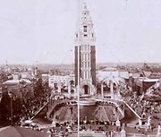
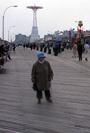
- ↑ This photograph was taken prior to 1995, as evinced by the fact that MCU Park does not appear to the left of the Parachute Jump, and the Half Moon Hotel (the U-shaped building just below the photo's center) is still standing.
- ↑ Joan Vinckeboons (Johannes Vingboon), "Manatvs gelegen op de Noot Riuier", 1639. Coney Island is labelled "Conyne Eylandt". Image of Vinckeboons map at Library of Congress.
- ↑ Library of Congress New Netherland Website Lists Conyne Eylandt as Dutch name for Coney Island.
- ↑ "De Nieu Nederlandse Marcurius", Volume 16, No. 1: February 2000. This is the newsletter of the New Netherland Project. Cites New Netherland map labeling "Conyne Eylandt" in 1639 Johannes Vingboon map.
- ↑ Robert Morden, "A Map of ye English Empire in the Continent of America", 1690. Coney Island is labelled "Conney Isle". Image of Morden map at SUNY Stony Brook.
- ↑ Henry Popple, "A Map of the British Empire in America", Sheet 12, 1733. Coney Island is labelled "Coney Island". Image of Popple Map can be found at David Rumsey Map Collection
- ↑ Illustrated in Eric W. Sanderson, (2009). Mannahatta: A Natural History of New York City p. 47; in 1779 the island was a cluster of three low hummocks in the shallow "East Bank" flats at the eastern end of Gravesend Bay.
- ↑ John H. Eddy, "Map Of The Country Thirty Miles Round the City of New York", 1811. Coney Island is labeled "Coney I." Image of Eddy Map can be found at David Rumsey Map Collection.
- ↑ Refer to maps given above.
- ↑ Coney Island Gets a Name
- ↑ Matus, Paul. "The New BMT Coney Island Terminal". The Third Rail Online. http://thethirdrail.net/0305/stillwell4.html. Retrieved 2007-08-29.
- ↑ Lombino, David (November 13, 2006). "A $1.5 Billion Vision For Coney Island". The New York Sun. http://www.nysun.com/new-york/15-billion-vision-for-coney-island/43372/. Retrieved 2010-08-05.
- ↑ "Imagineconey". Imagineconey. http://imagineconey.com. Retrieved 2010-03-17.
- ↑ "New York City Department of City Planning - Amanda M. Burden, Director". Nyc.gov. 2010-03-04. http://www.nyc.gov/html/dcp/home.html. Retrieved 2010-03-17.
- ↑ "Uniform Land Use Review Procedure (ULURP) - New York City Department of City Planning". Nyc.gov. http://www.nyc.gov/html/dcp/html/luproc/ulpro.shtml. Retrieved 2010-03-17.
- ↑ Levitt, David M.; Ivry, Bob (November 28, 2006). "Coney Island's Astroland Sold, Will Close Next Year". Bloomberg News. http://www.bloomberg.com/apps/news?pid=newsarchive&sid=aAUnFAdku_FA. Retrieved 2010-08-05.
- ↑ Ramirez, Jeanine (November 14, 2006). "Plans Coming Together For Coney Island Amusement Park Expansion". NY1. http://www.ny1.com/?SecID=1000&ArID=64315. Retrieved 2010-08-05.
- ↑ Edroso, Roy (June 17, 2009). "Planning Commission Approves Unloved Coney Plan". The Village Voice. http://blogs.villagevoice.com/runninscared/archives/2009/06/planning_commis.php. Retrieved 2010-08-05.
- ↑ "Coney Island amusement park closing: News & Videos about Coney Island amusement park closing - CNN iReport". Ireport.com. http://www.ireport.com/ir-topic-stories.jspa?topicId=22385. Retrieved 2010-03-17.
- ↑ Calder, Rich (September 5, 2007). "Ride Over for Coney Classics". New York Post. http://www.nypost.com/seven/09052007/news/regionalnews/ride_over_for_coney_classics.htm. Retrieved 2007-09-05.
- ↑ See Deno's Wonder Wheel
- ↑ Welcome to Coney Island Polar Bear Club
- ↑ Newborn Dead: Brooklyn embraces horror
Further reading
- Rem Koolhaas, Delirious New York: A retroactive Manifesto for Manhattan (Academy Editions, London, 1978; republished, The Monacelli Press, 1994 — a large part of the book focuses on Coney Island amusement parks)
- John F. Kasson, Amusing The Million: Coney Island at the Turn of the Century (Hill and Wang, New York, 1978; Distributed in Canada by Douglas and McIntyre Ltd.)
- Charles Denson, Coney Island: Lost and Found (Ten Speed Press, 2002.)
External links
- Coney Island History Project
- Coney Island Visitor Guide, Maps, and More!
- 1911 Britannica article
- Astella development Corporation redevelopment plan
- Coney Island Development Corporation
- ImagineConey, an initiative by the Municipal Art Society to develop bold new ideas for Coney Island
- Bland as Sand: Developers Stalk Coney Island, The Indypendent
- Gritty and Trashy… That’s Why I Love It, The Indypendent
- NYC Landmark designation report on Childs Restaurant building (pdf)
- Bruce, Jeannette. "Where The Fun Was," Sports Illustrated, August 28, 1967.
- A photographer's dream scape in the city
|
|||||||||||
|
|||||||